This Map's Story:
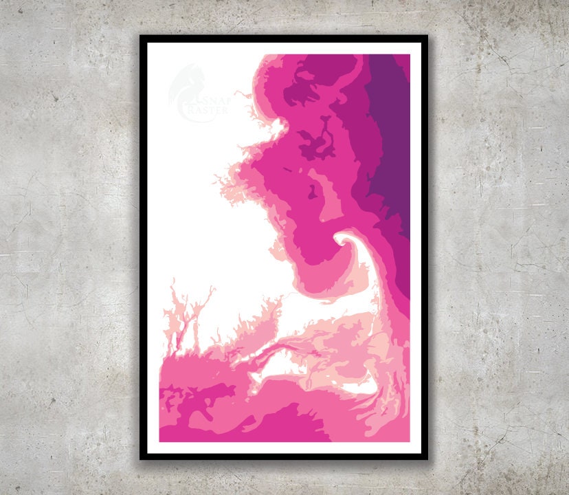
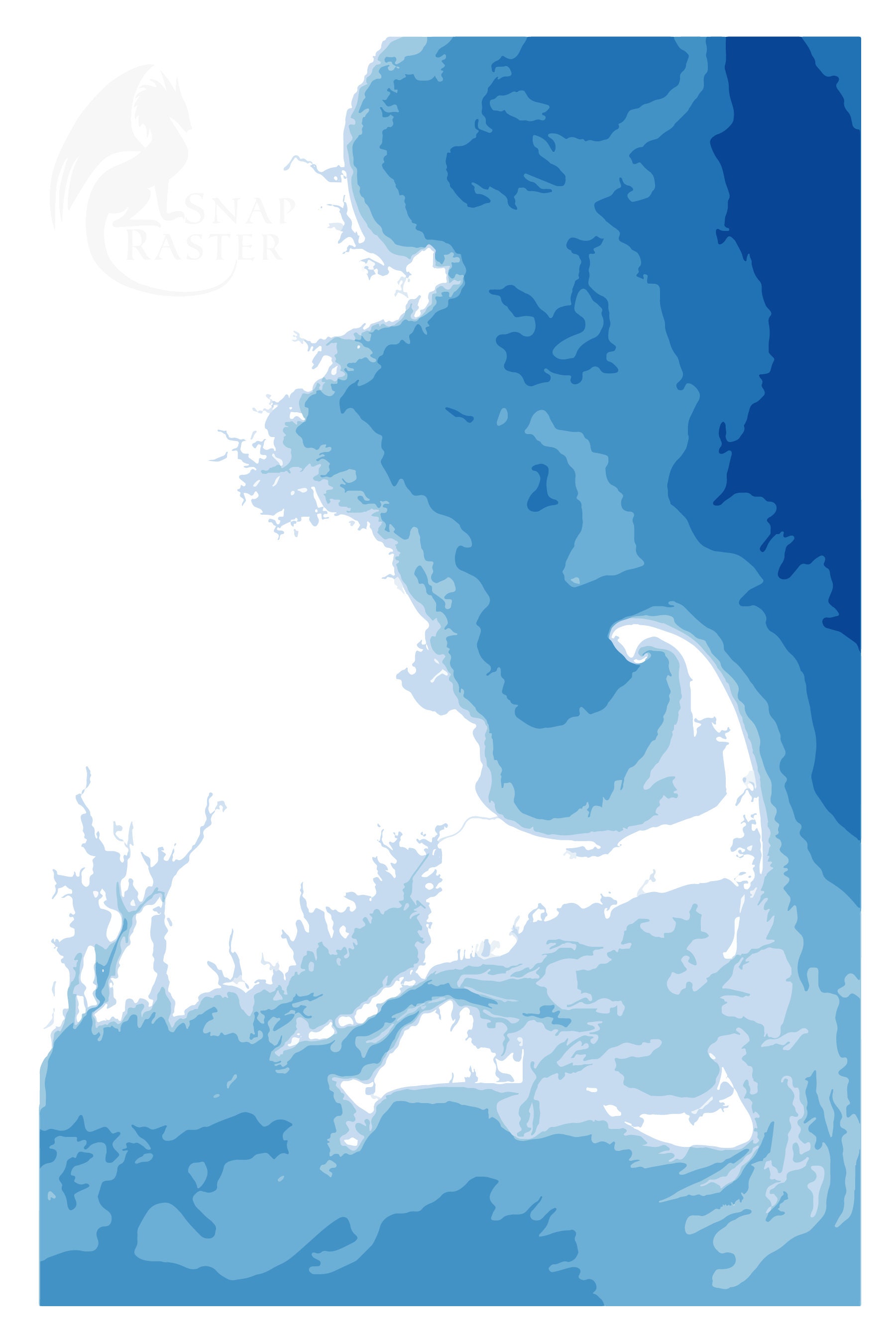
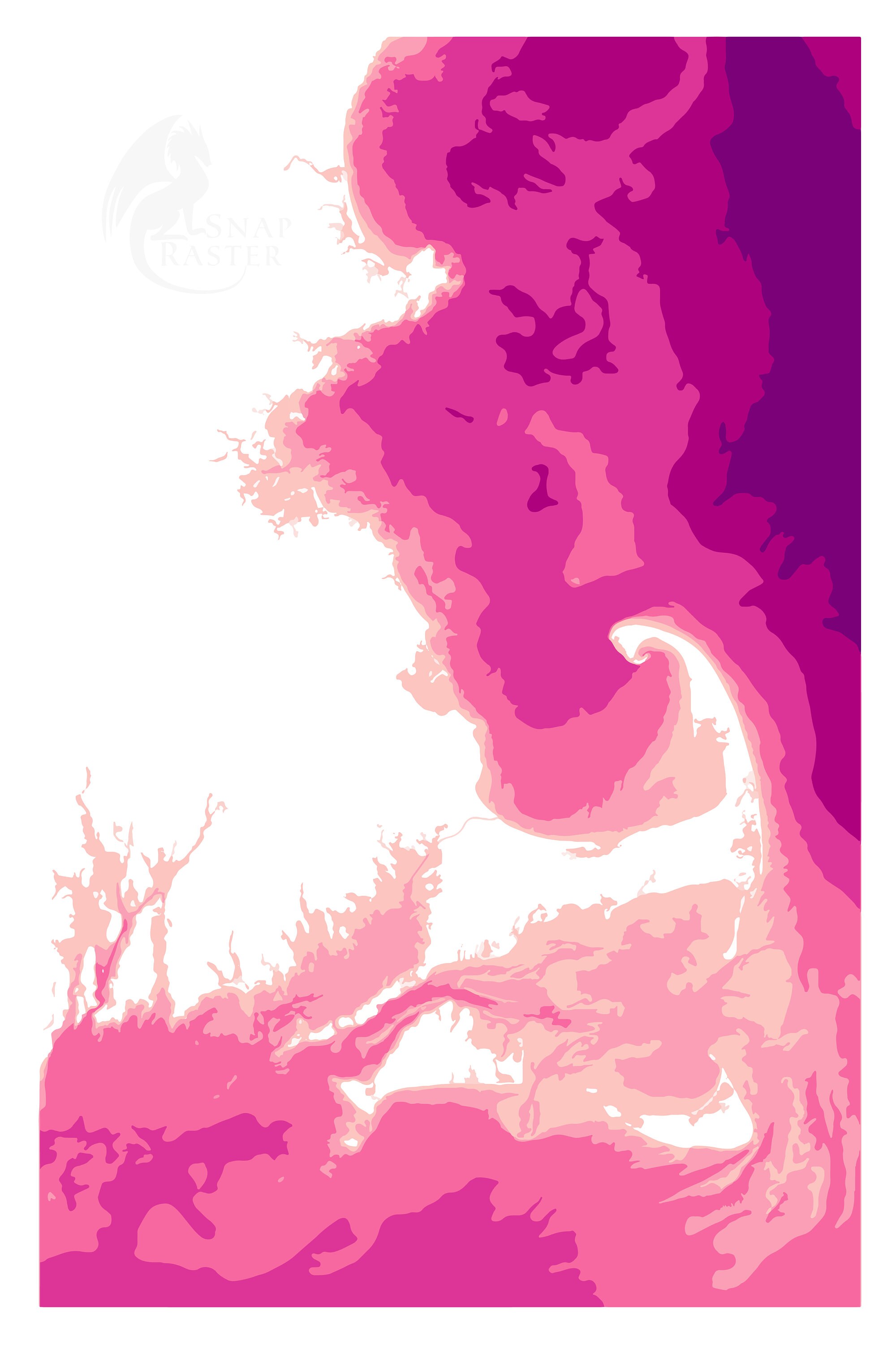
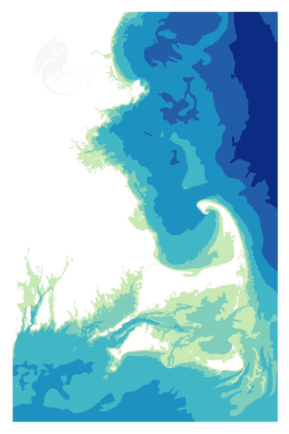
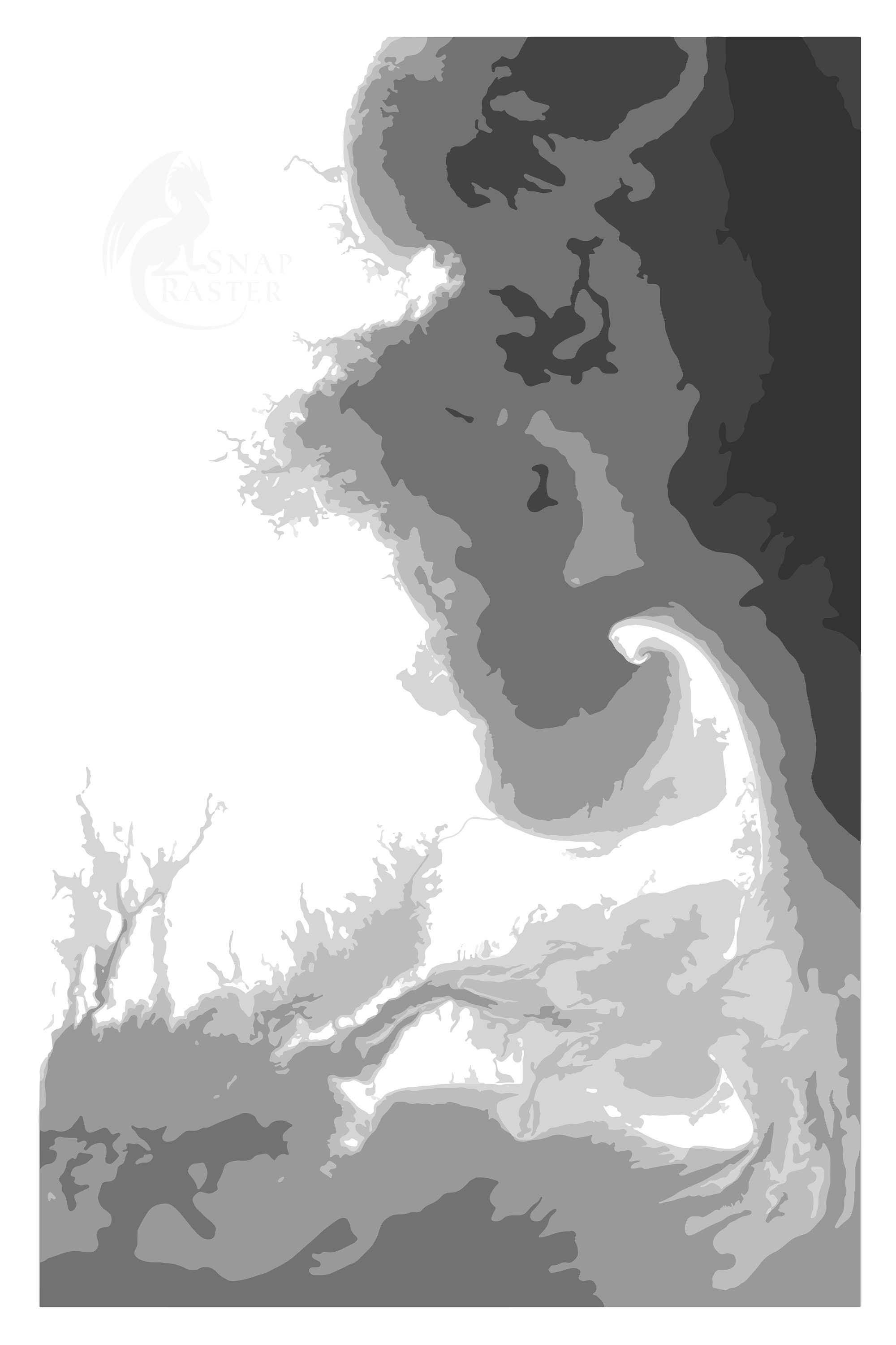
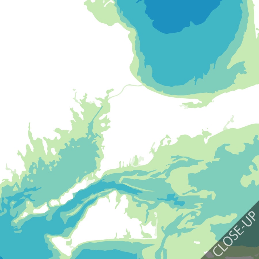
I wanted to map the coastline of Cape Cod because of its unique shape that defines Massachusetts. This map illustrates the Atlantic Ocean using various color spectrums to show water depth, or bathymetry. This allows viewers to use the water to identify coastal features along Cape Cod, Nantucket, the Vineyard, and Boston Harbor.
Color:
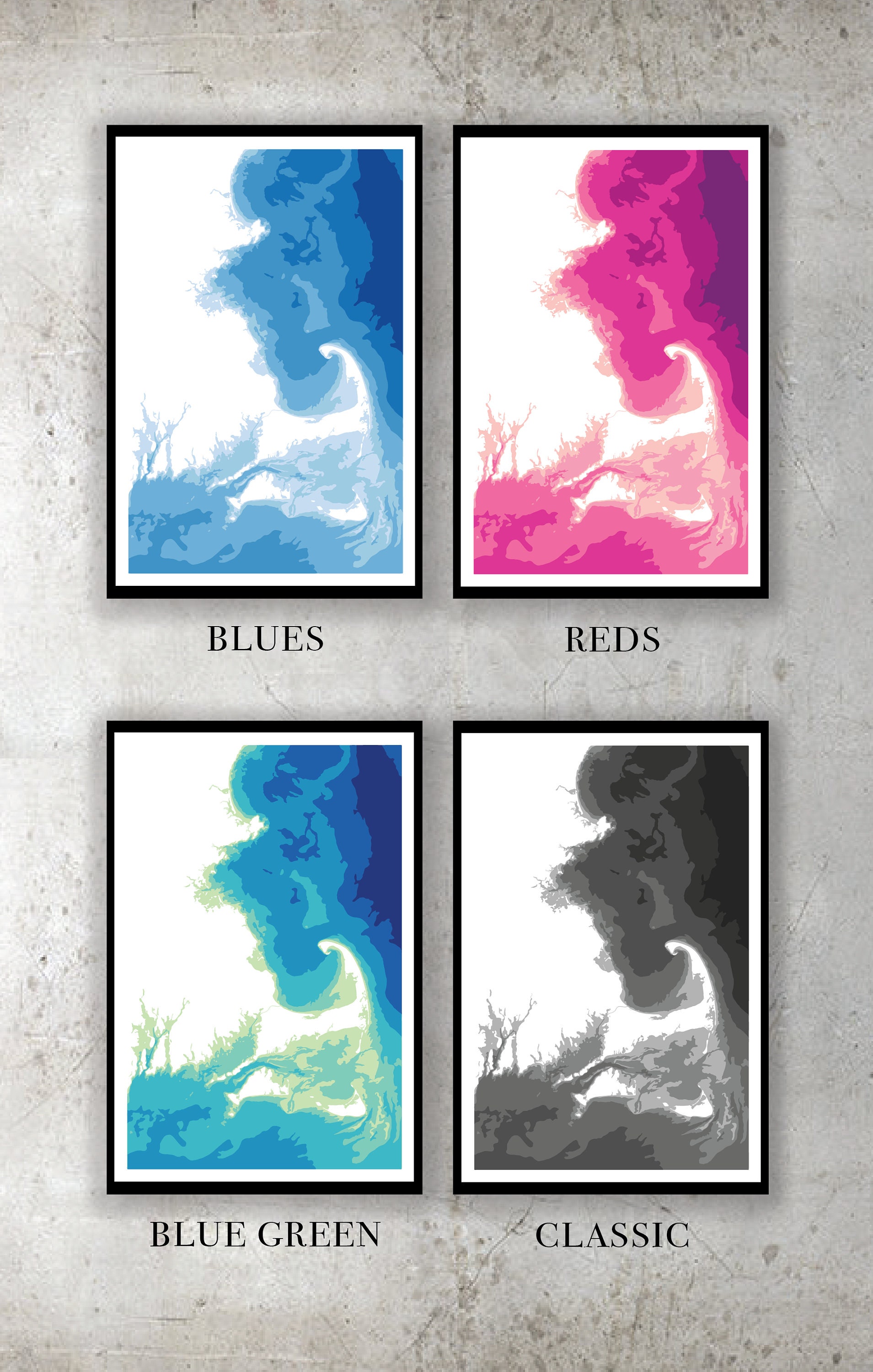
This map is available in the four color schemes pictured. Please contact me about custom color requests.
Size:
Prints available in 12x18, 18x24, and 20x30 -- size includes .5" white border.
Note on the Process:
This is a digitally made GIS-map using data from MASS GIS. Each map is locally printed using archival toner ink on 120lb paper with a matte finish. The 18x24 and 20x30 sizes are printed on 10 mil ultra-smooth matte poster paper, which produces a brighter color and smoother texture.
Shipping:
I hand-check each map for flaws and will personally package and ship with shipping insurance within 1 week of ordering (please allow additional time for custom color scheme requests).
**Color may vary between monitor and print
**Frame not included
Check out my other maps: www.snapraster.com
See other elevation maps: https://www.snapraster.com/shop/18702875/elevation-maps
Returns & Exchanges
I gladly accept returns and exchanges
Just contact me within: 14 days of delivery
Ship items back to me within: 30 days of delivery
I don't accept cancellations
But please contact me if you have any problems with your order.
The following items can't be returned or exchanged
Because of the nature of these items, unless they arrive damaged or defective, I can't accept returns for:
- Custom or personalized orders
- Perishable products (like food or flowers)
- Digital downloads
- Intimate items (for health/hygiene reasons)
Reviews (1)
Average:
Nov 4, 2016
Love this piece. The colors are perfect and the seller was excellent to work with. Will definitely order again!
Lauren Pero